Largest magnetic map of Europe with cultural and historical images. .. more


Largest magnetic map of Europe with cultural and historical images. .. more
| Code: | Variant: | Price: | Availability: |
|---|---|---|---|
We would like to introduce the largest magnetic map of Europe in our offer, featuring illustrations from the renowned toy manufacturer Woody.
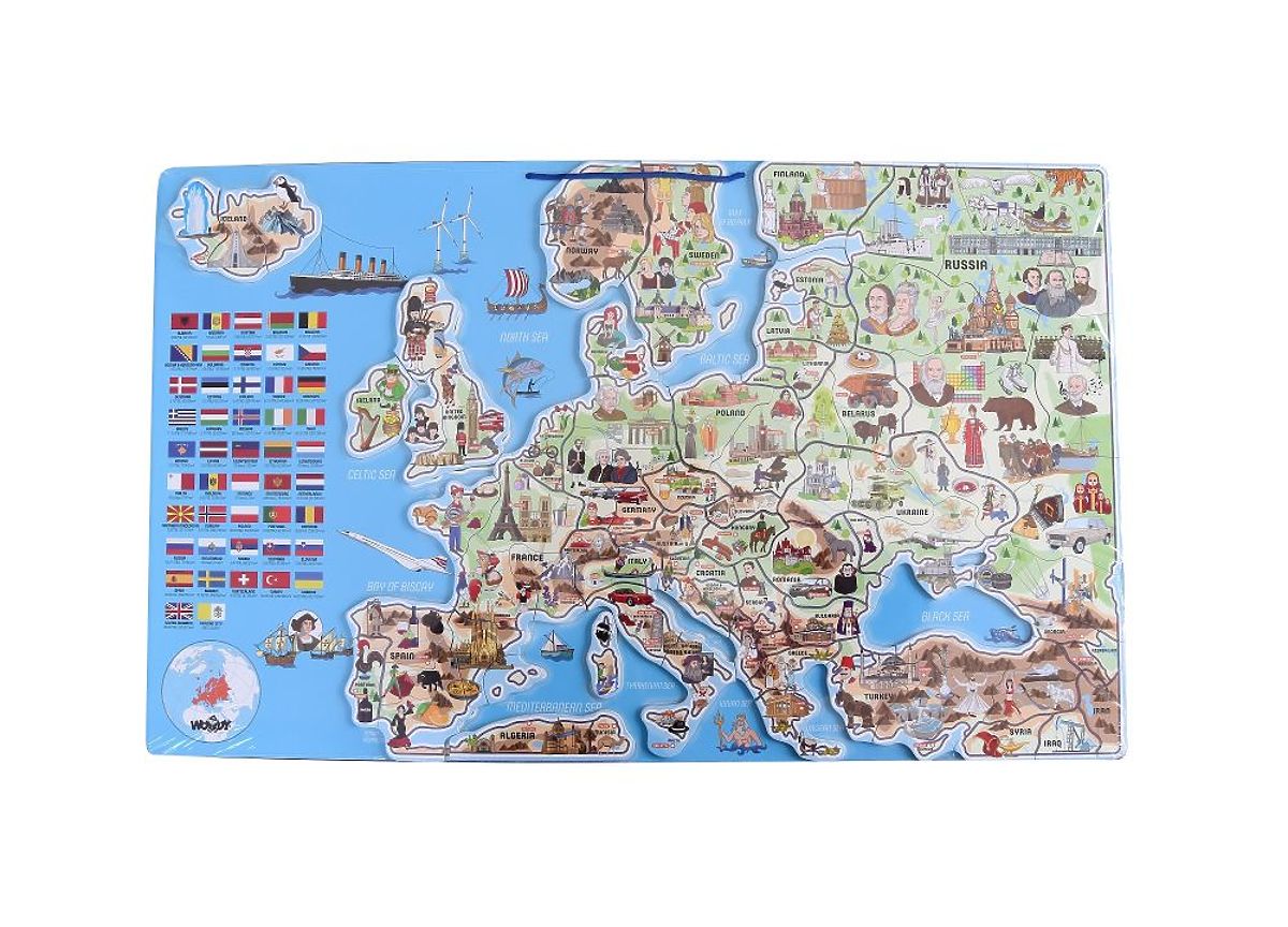
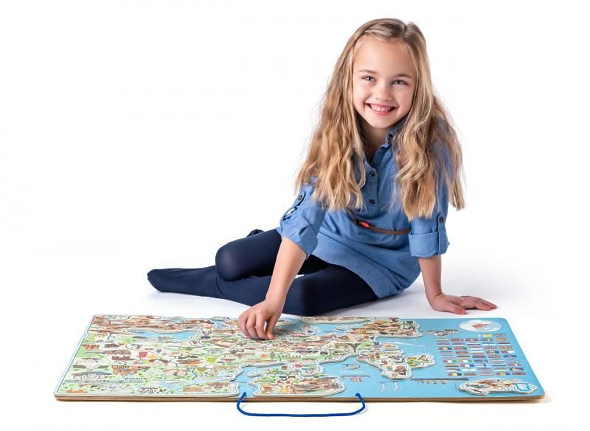
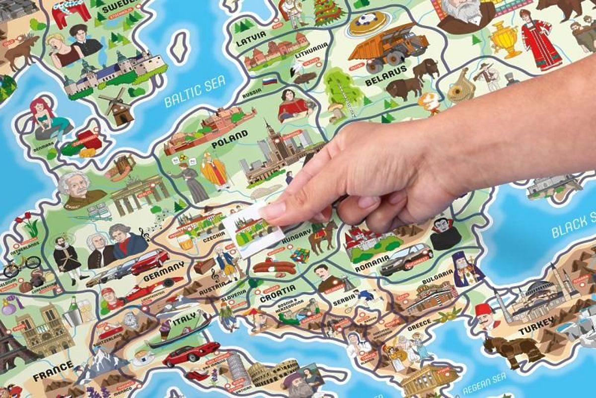
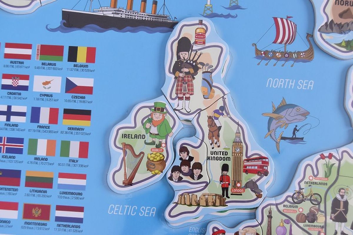
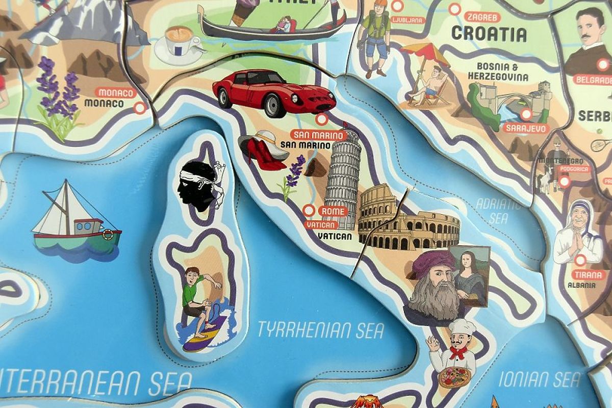
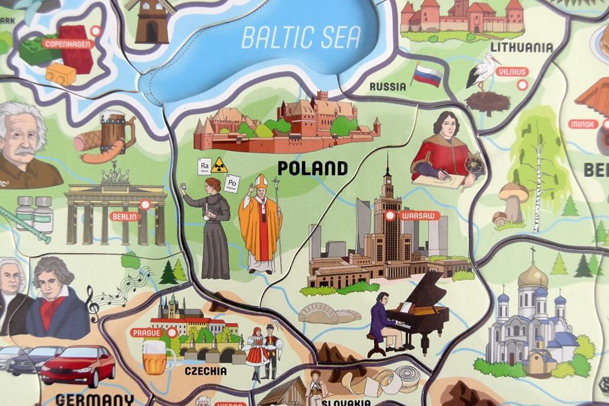
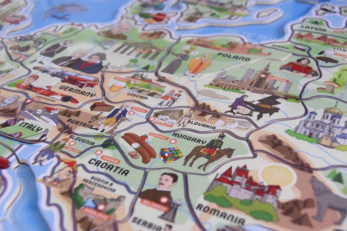
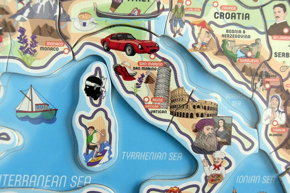
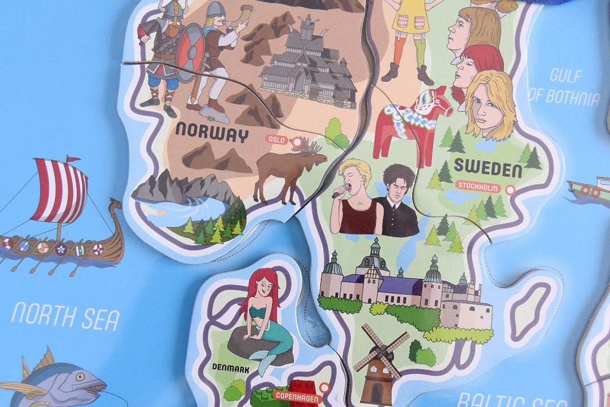
Through play, children learn the size, shape, and location of individual European countries. The map depicts our continent from the distant Russian tundra through the Middle Eastern deserts to Iceland. Each country (except for states like Vatican City, Andorra, Liechtenstein, Malta, and Monaco) has interesting images associated with its culture, history, or landmarks. The larger the country, the more images are found within its borders. For example, in Poland, we can find the famous Polish Pope John Paul II or the Malbork Castle, while in England, we can see the famous Stonehenge or a red double-decker bus. The same applies to the magnetic puzzle, where countries like Portugal consist of one piece, while Russia has up to 10 puzzles. From now on, every child will know which countries border Poland or through which states they need to travel to go on holiday to sunny Italy.
A great advantage of the puzzle is the legend on the left side of the map, where we can find important data about the country, such as area or population. Each country also has its capital marked on the map. But that's just one of the many advantages of this gigantic map.
After removing the puzzles from the map, a physical map of Europe appears, showing Earth's surface features (water, vegetation, elevations) along with its relief (terrain layout). On the physical map, we can find details such as the height of the largest peaks in the region.
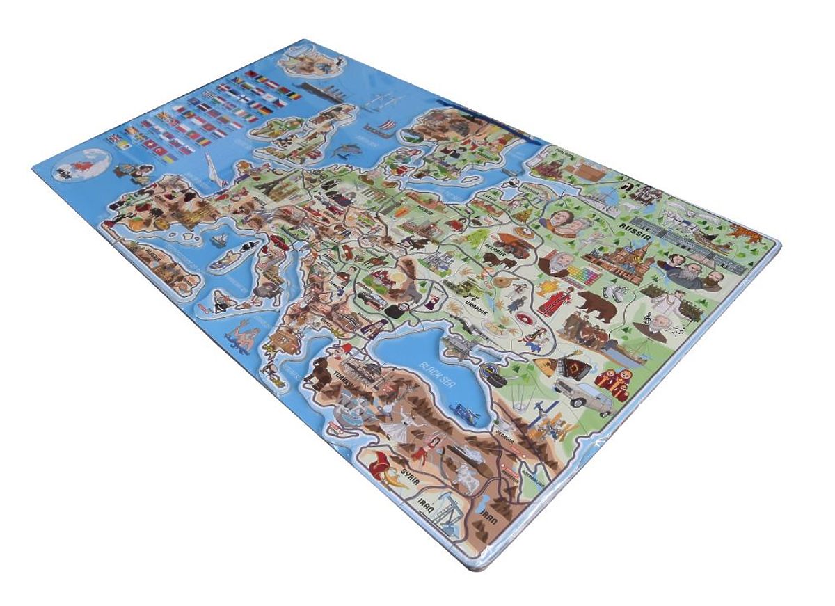
On the back of the map is a board with blocks that precisely reproduce the images on the front of the map. In the case of square puzzles, each image is labeled, allowing us to learn about interesting landmarks, personalities, foods, animals, or events assigned to the region. This toy is designed in such a way that when assembling the map, a child will want to find out what the Trojan Horse was, who Dracula was, and learn the history of the Titanic.
An excellent offer for kindergartens as part of their equipment.
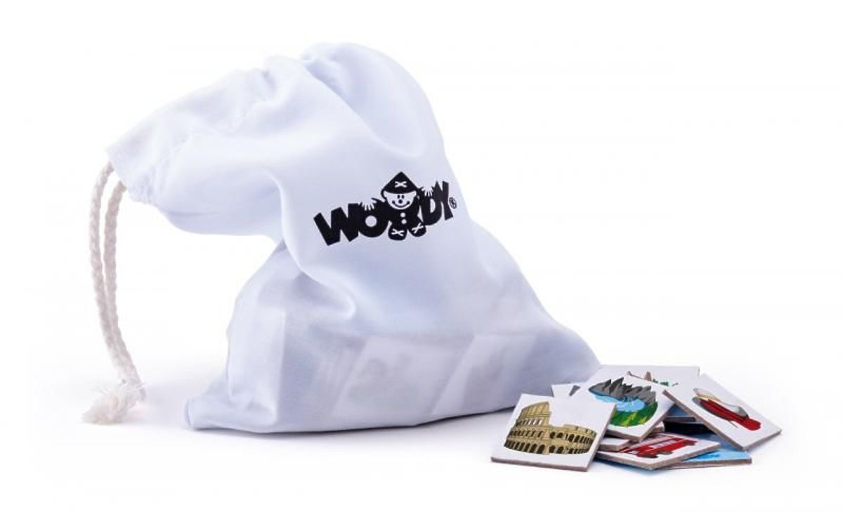
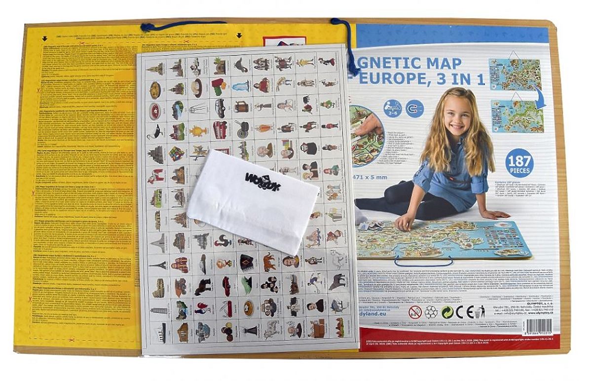
In addition to educational values, the manufacturer also ensured an exciting game, where the player's task is to draw a cardboard block from a bag and then place it in the correct spot on the map. Full game rules in Polish can be found on the label located on the back of the board.
The set consists of a total of 187 pieces:
Due to the large size of the map, only courier delivery is possible.
Material: wood
Dimensions: 77 x 47 cm
Age: 4+
Reference: WD91231
CE Declaration of Conformity
Material: wood Dimensions: 77 x 47 cm Age: 4+ Reference: WD91231 CE Declaration of Conformity
Help others customers with order.
Write a review on this product .


 children's furniture specialist